
Based on a cooperation between the Montenegro Defence Ministry and Defence Security Cooperation Agency of the United States in Montenegro, the Montenegro Navy officer, corvette captain Brnaislav Gloginja was assigned to an intense one-year post-graduate study in hydrography at the University of Southern Mississippi (USM), part of the NASA Stennis space center in Galfport town.
Tuition expenses are covered by the US government. Hydrography is an applied science dealing with measurement and description of physical characteristics of oceans, seas, coastal areas, lakes and rivers with a primary goal of safe navigation. The competent Montenegro institution for this area is the Hydrography Sector of the Hydrometeorology and Seismology Institute. The Hydrography and Oceanography Sector headed by Gloginja is a mixed civil-military team operating hydrography measurement at sea, lakes and rivers for state and business subjects, as well as special naval measurements together with the Montenegro navy. There are only two universities in the US with hydrography studies, and USM began its program in 1999. The programs are accredited with the International Hydrography Organization (IHO), and besides becoming a master of hydrography studies, the IHO awards the graduate the A category hydrographer title, its highest rank.
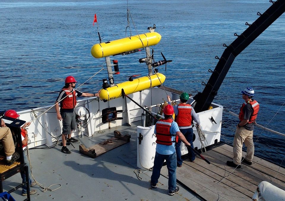
Post-graduate hydrography studies are a two-year program, but for students whose tuition is covered by the US Defence Ministry or IHO, which is the case for Branislav Gloginja, the program last a year with the same number of classes, practical exercises and exams. Students also have an opportunity to work with the most modern special technical equipment. It is interesting that students, practicing measurements in the Bay of Mexico, send their results to National Ocean Service of the National Oceanic and Atmospheric Administration which examines them and if found acceptable, uses them to update US naval charts.
“Construction of marinas, underwater installation, the beginnings of geophysical and geotechnical scanning for gas and oil exploration in the Adriatic, sea borders, the need to build separation navigation zones in the Boka Kotorska Bay, the anchorage of Bar Harbor, as well as new electronic navigational charts, the increase of naval and civil ships after Montenegro was accepted to NATO, management of coastal engineering, sea level rise, are all evident needs for further development and advancement of the Montenegro hydrography service,” said Gloginja for Vijesti.
Translated from Vijesti Online, for the original click here.